Takamaka, Grand Étang, the primary forest of Bébour-Bélouve, Sainte-Anne church, rafting on the Marsouins river. The rural, rainy east is home to some of Reunion Island's most striking natural sites, a world away from the beach resorts of the west coast. Here's how to explore it without missing a thing.
800m Takamaka viewpoint530m Grand Étang6,000ha Bébour-Bélouve€35 Marsouins rafting
Quick facts
Saint-Benoît at a Glance
Type
Capital of the east · rural
Population
≈ 38,000 residents
Distance from Saint-Denis
≈ 50km · 50 min
Distance from Saint-Pierre
≈ 90km · 1h30
Climate
21-29°C, very humid
Flagship viewpoint
Takamaka, 800m
The island's only lake
Grand Étang, 530m
Market
Saturday morning, town hall
Saint-Benoît, Reunion Island's second-largest municipality by area after Saint-Paul, stretches from the sea up into the forested highlands. It's also one of the wettest places on the planet, which explains why it's so full of waterfalls, natural pools and primary forest.
4 must-sees
Takamaka, Grand Étang, Bébour, Sainte-Anne
The four sites not to miss in Saint-Benoît, from the most spectacular to the most historic.
Takamaka Viewpoint
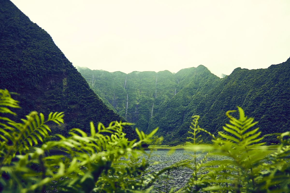
A winding 16km road from Saint-Benoît climbs to 800m, facing one of the island's wettest cirques. From the platform you can see the waterfalls streaking down the near-vertical green ramparts (the cirque's cliff walls), as well as the EDF Takamaka I and II hydroelectric dams. From the car park, the Takamaka-Bébour trail heads off into the primary forest (5h, 27 ladders, for fit hikers). Go early in the morning, before the mist rolls in.
Grand Étang, the Island's Only Lake
At 530m, Grand Étang is Reunion Island's only natural lake of any real size. The trail from the car park (30 min) leads to a wooden viewpoint facing a green cirque. Walking all the way round the lake takes about 2h, through woodland and clearings and past the Bras d'Annette waterfalls. Look out for moorhens, stonechats and Réunion harriers. Swimming is banned.
Bébour-Bélouve Primary Forest
A 6,000-hectare forest shared with Plaine des Palmistes, with the feel of a high-altitude rainforest: century-old tamarind trees, tree ferns, moss, lichen and orchids. The École Normale trail (1h to 1h30, easy) is a good first taste. The Bébour-Bélouve-Trou de Fer route is for well-prepared hikers, in dry conditions or with a guide. Bring a windproof jacket: it can be 12°C under cloud, even when it's 28°C in Saint-Benoît.
Sainte-Anne Church, Creole Baroque
10 minutes from the centre, this is Reunion Island's most unusual church. The facade was carved entirely by Brother Soubise and his parishioners between 1920 and 1940: friezes, niches, scrollwork and angels in relief. It's a listed historic monument, nicknamed the Creole Sagrada Familia. Free to visit, with no booking needed. Combine it with a picnic in the church gardens and a stop at the Sainte-Anne bakery, known for its pain au chocolat.
Whitewater
Marsouins Rafting and Rivière des Roches Canyoning
Two of the island's best-known rivers flow through Saint-Benoît: the Marsouins, running down from Piton des Neiges, and the Rivière des Roches to the north, on the border with Bras-Panon. Both are playgrounds for the east coast's whitewater activities.
Marsouins River Rafting, From €35
A guided 8km raft descent over class II and III rapids, weaving through small canyons and clear pools. From age 8, equipment provided, half a day. It's Saint-Benoît's signature activity and the cheapest on the whole island, rated 4.7 out of 5 from 75 verified reviews.
Canyoning on the Rivière des Roches is more demanding, with moderate abseils, jumps of up to 8m and deep rock potholes. Intermediate level, half a day, €75-85.
Saint-Benoît has no white-sand lagoon beach, but its natural pools are well worth the detour. Always check the weather over the past 24 hours: the Marsouins river can rise very quickly after heavy rain.
Bassin Bleu de Sainte-Anne
5 minutes from Sainte-Anne church. Crystal-clear water fed by the Marsouins river, with swimming allowed except when the river is in flood. Black basalt pebbles, shade and a family-friendly atmosphere. Easy to reach: from the church, cross the bridge, then go 300m to the left at the picnic shelters. Busy on Sundays.
Bassin de la Mer
Upstream from Bassin Bleu, and wilder. Deep water and a waterfall, for confident swimmers only. Avoid it after rain: the Marsouins river rises fast. It's a 15-20 minute walk on a slippery trail from the Bassin Bleu car park.
Bassin Bleu de Bethléem
A former pilgrimage site on the Marsouins river, downstream from Sainte-Anne. A wide pool of clear water, and camping by the river is tolerated. Ideal for a quiet afternoon. Access via the D54.
Rivière des Roches (Bras-Panon)
Saint-Benoît's northern boundary. Natural pools carved into the basalt, often with clear water, and several calm spots. This is where family canyoning in the east began. You can spend a half-day swimming and exploring with a guide.
The rural east has few hotels and plenty of quiet spots. A campervan hired through Yescapa lets you sleep as close as possible to the sites, be at the Takamaka viewpoint for sunrise, and move freely between Grand Étang, Bébour and Plaine des Palmistes. Sleeping in your vehicle is tolerated in some car parks: by the picnic shelters at Bassin Bleu de Sainte-Anne, the Grand Étang car park and the picnic areas at Bébour. The one rule: leave no litter.
Helicopter Tours: See What You Can't Reach on Foot
From the viewpoint, you only see a fraction of the Takamaka cirque. From the air, you see the valley's true depth, its hydroelectric dams, dozens of hidden waterfalls and the primary forest of Bébour-Bélouve next to it. Flights usually include nearby Trou de Fer, one of the island's tallest waterfalls.
Saint-Benoît's street market runs every Saturday morning in the square in front of the town hall. Quieter than Saint-Pierre's and smaller than Saint-Paul's, it brings together producers from across the east: lychees and longans in season, mangoes, jackfruit, Victoria pineapples, Bourbon vanilla, mountain honey, local herbal teas, fresh fish, samosas and piping-hot bonbons piment (chilli fritters).
Arrive before 10.30am for the best choice and the freshest produce. You can also grab a Creole meal to take away: cari poulet (chicken curry), rougail saucisse (a spicy sausage stew) or bouchons (steamed dumplings). Woven vacoa (screwpine) baskets and straw hats make typically Reunionese souvenirs at a fair price.
For eating out, there are several good places along the coast: seafront Creole restaurants near Pointe du Tremblet, roadside snack bars between Saint-Benoît and Sainte-Rose for smoked jackfruit (ti-jacques boucané), and guesthouses serving their own home-cooked table d'hôte dinners.
Within an hour's drive
Excursions from Saint-Benoît
Saint-Benoît makes an excellent base for exploring the whole windward (east) coast and the north-east. Here are six half-day or full-day ideas, all less than an hour's drive away. Roland-Garros airport is 50 minutes up the N2, and a rental car can be waiting for you there: weigh up the hire companies before you fly.
What is there to do in Saint-Benoît, Reunion Island?
Saint-Benoît is home to the east's most striking natural sites: the Takamaka viewpoint (800m, with a string of waterfalls), Grand Étang (the island's only lake, a 30-minute walk from the car park), the Bébour-Bélouve primary forest, and Sainte-Anne church, a listed historic monument. For activities: rafting on the Marsouins river from age 8, canyoning on the Rivière des Roches and horse riding around Grand Étang. There's a street market on Saturday mornings in the square in front of the town hall.
How do you get to the Takamaka viewpoint?
From central Saint-Benoît, take the D53 through Bras-Canot, then the Takamaka road: 16km of hairpin bends along the river's right bank, about a 30-minute climb. There's free parking at the end of the road, by the viewpoint at 800m. Best avoided in heavy rain, as the road is narrow and slippery. Go early in the morning to see the waterfalls in soft light, before the mist rolls back in.
Is Grand Étang worth the trip?
Yes. It's Reunion Island's only high-altitude lake (530m), tucked at the bottom of a green cirque. The walk to the viewpoint from the car park takes 30 minutes on a wide trail, well suited to families. Walking all the way round the lake takes about 2h and passes the Bras d'Annette waterfalls. Swimming is banned, but the setting is worth the walk. There's also a page on the site about bivouacking at Grand Étang and the Bras d'Annette waterfalls.
Which activity should you pick for a first visit to Saint-Benoît?
With just one day, combine a morning at the Takamaka viewpoint with an afternoon at Grand Étang: they go well together and aren't too physically demanding. For a guided activity, rafting on the Marsouins river is the east's most iconic experience, open from age 8 and from €35 on Manawa. It's also the cheapest activity on the whole island.
Can you swim in Saint-Benoît?
Not in the sea (the east coast is exposed, with few proper beaches), but you can in the rivers. Bassin Bleu de Sainte-Anne is the family-friendly spot, except when the river is in flood. Bassin de la Mer is for confident swimmers only and best avoided after rain. The Rivière des Roches has several calm spots. My full guide to the island's waterfalls and pools covers them all.
How many days should you plan for Saint-Benoît?
Two full days to see Takamaka, Grand Étang, Sainte-Anne church and a natural pool without rushing. Three days if you add a day at Bébour-Bélouve with the Trou de Fer hike, or head out to Salazie and Sainte-Suzanne. Saint-Benoît also makes an excellent base for exploring the whole windward (east) coast.
What is there to see in the Bébour-Bélouve forest?
It's one of the island's last high-altitude primary rainforests, covering 6,000 hectares: tree ferns, century-old tamarind trees, moss, lichen and endemic orchids. The École Normale trail (1h to 1h30, easy) is a good first taste. For well-prepared hikers there's the Bélouve-Trou de Fer route (take care, fog is frequent). It can drop to 12°C in the rain, so a windproof jacket is essential even in summer.
When does the street market take place?
Every Saturday morning in the square in front of Saint-Benoît town hall. Arrive before 10.30am for the best choice and to avoid the crowds. You'll find local fruit (lychees, mangoes, jackfruit, longans depending on the season), spices, herbal teas, honey, fresh fish, samosas, bonbons piment (chilli fritters) and iced juices. Smaller than Saint-Pierre's market, but more authentic.
Where should you stay in Saint-Benoît?
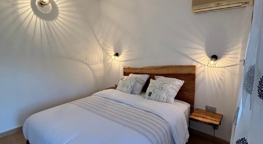
Accommodation is more rural than on the west coast: charming guesthouses, gîtes (rural guesthouses) in the hills towards Grand Étang or Plaine des Palmistes, and a handful of simple hotels in town. Expect €60-100 for a guesthouse. Diana Dea Lodge in Sainte-Anne (10 minutes away) is the premium option. For outdoor lovers, a campervan hired through Yescapa lets you sleep as close as possible to Grand Étang or Bébour (camping is tolerated).
How far is Saint-Benoît from Roland-Garros airport?
About 50km via the N2, a 50-minute drive outside rush hour. At morning and evening rush hour the N2 gets congested around Sainte-Marie, so allow 1h15. Without a car, Car Jaune (the island's coach network) line 02 runs from Saint-Denis to Saint-Benoît, but getting around the east without a car is very limited.
Is rafting on the Marsouins river suitable for children?
Yes, from age 8. It's a guided class II and III run over 8km, with equipment provided, including optional jumps, clear pools and small canyon sections. Prices start at €35 on Manawa, cheaper than canyoning, and it lasts half a day. See my Marsouins rafting page for details.
Can you see Takamaka by helicopter?
Yes, and the view is on a completely different scale from what you see at the viewpoint. Flights over the east pass above the Takamaka cirque, Trou de Fer and Bébour-Bélouve, landscapes you can't reach on foot. Prices run from €205 to €345 depending on duration and operator. Details and reviews are on my helicopter tours page.