10 trails · Reunion Island

Best Hikes in Reunion Island

From the Bébour Botanical Trail (1.5 hours) to the 2-day ascent of Piton des Neiges, taking in Mafate, Trou de Fer and Piton de la Fournaise along the way: 10 handpicked trails, from easy to very strenuous.

3,070 m Piton des NeigesUNESCO Pitons and cirques10 trails handpicked

Reunion Island is a world-class playgroundfor tropical mountain hiking. UNESCO-listed since 2010 (the Pitons, cirques and cliffs), the National Park's roughly 1,000 km of trails cover every level: family walks through primary forest, climbs above the clouds, road-free crossings of entire cirques.

Here is my selection of the 10 best hikes to do on a trip, ranked by area and level, with distance, elevation gain, duration and practical tips.

They're spread from Le Brûlé in the north to Pas de Bellecombe in the south-east, and nearly every one starts at the end of a highland road. To fit several into one trip, the logistics get far simpler if you rent your own car (for Mafate, the Col des Bœufs can also be reached by 4x4 taxi).

My top 3

The signature hikes

1. Piton des Neiges
The summit (2 days)

The roof of the Indian Ocean at 3,070m. Sunrise above the three cirques. Unforgettable.

2. Mafate via the Col des Bœufs
The only cirque with no road (2-3 days)

Stay with locals in a remote hamlet, with ever-changing scenery and a sense of pure adventure that's rare in France.

3. Trou de Fer from Bélouve
The viewpoint (1 day)

A 300m-deep chasm in the primary forest. Worth combining with a night at the Bélouve gîte.

The 10 trails

From easy to very strenuous

Distances, elevation gain and durations from ONF Réunion and the National Park. The elevation profiles are stylised (illustrative). For full GPX tracks, the IBP rating and each trail's open/closed status: Randopitons.re (the local reference) or ONF Réunion.

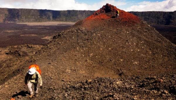
The Formica Léo volcanic cone with its red scoria at the foot of Piton de la Fournaise
Trail 01ModerateFamily volcano
Volcano · south-east

Formica Léo and Commerson Crater

Distance

≈ 6 km

Elevation gain

≈ 150 m elevation gain

Duration

≈ 2.5 hours

A spectacular mini-hike at the foot of Piton de la Fournaise. Formica Léo is a small red-orange secondary crater shaped like a perfect cone, and Commerson Crater is a much wider one. Easy to reach from the Cité du Volcan, ideal for families with kids aged 8 and up.

Elevation profile
indicative
2460 m
2310 m
+150 m
Practical info

Direct access from the volcano road (car park). Sunscreen is essential, and it's cool on the way up. Easy to combine with a visit to the Cité du Volcan (Bourg-Murat) nearby.

Trail markers: Marked National Park trail.
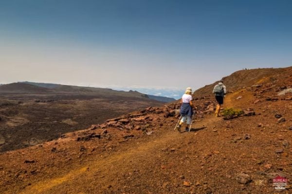
Hikers on the Plaine des Sables, Martian red earth, a mountain range in the background
Trail 02ModerateMartian landscape
South-east · volcano entrance

Plaine des Sables and Pas des Sables

Distance

≈ 8 km return

Elevation gain

≈ 200 m elevation gain

Duration

≈ 3 hours

The gateway to the volcano, a Martian landscape of red and black ash and scoria. A marked trail crosses the Plaine des Sables (2,200m) to the Pas des Sables viewpoint. Ideal alongside, or as an alternative to, climbing Piton de la Fournaise.

Elevation profile
indicative
2400 m
2200 m
+200 m
Practical info

Access from Plaine des Cafres via the volcano forest road. The trail is fully exposed, with no shade. Cool in the morning (≈12-18°C). Easy to combine with a stop at the Cité du Volcan later in the day.

Trail markers: National Park markers plus forest road.

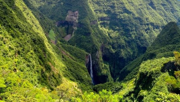
A plunging view over the Trou de Fer chasm in the green Bélouve forest, a waterfall in the background
Trail 03ModerateSpectacular view
Bélouve forest · Salazie cirque

Trou de Fer from Bélouve

Distance

≈ 12 km return

Elevation gain

≈ 200 m elevation gain/loss

Duration

≈ 4-5 hours

One of the island's most striking landscapes. A trail through the forest leads to a viewpoint overlooking the Trou de Fer chasm (300m deep, several waterfalls). A humid rainforest atmosphere with tree ferns. The view depends on cloud cover, so arrive early for a clear one.

Elevation profile
indicative
1700 m
1500 m
+200 m
Practical info

Access via the Bélouve gîte on the forest road from Hell-Bourg. An early start is essential (after 11am, a sea of clouds rolls in). The trail gets slippery after rain. The Bélouve gîte is ideal for an overnight stay and a dawn start.

Trail markers: National Park markers from the Bélouve gîte.

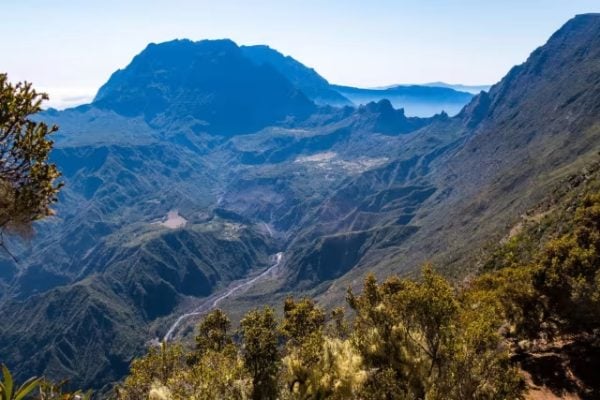
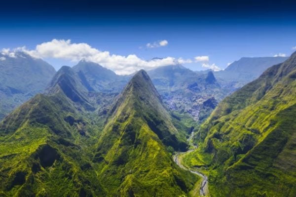
An aerial panoramic view of the Salazie cirque with its green mountains and winding river
Trail 04ModerateMafate view
Hauts de l'Ouest · 2,200m

Maïdo Viewpoint and Roche Plate

Distance

≈ 8 km return

Elevation gain

≈ 350 m elevation loss/gain

Duration

≈ 3-4 hours

Mafate's balcony. From the Maïdo car park, descend towards the Roche Plate trail with sweeping views down into the Mafate cirque. Expect a string of viewpoints, with the option to continue on to the Roche Plate settlement (+4-5 hours).

Elevation profile
indicative
2200 m
1850 m
+350 m
Practical info

Sunrise at the Maïdo (leave Saint-Paul before 5am). Cool in the morning (≈5-12°C). A cliffside trail, not for anyone afraid of heights. Easy to combine with a multi-day Maïdo-Cilaos traverse.

Trail markers: GR R3 (descent from the Maïdo).

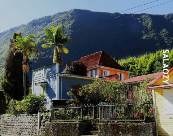
Colourful Creole houses in the village of Hell-Bourg with a green mountain in the background, a Salazie sign on the right
Trail 05ModerateHeritage plus nature
Salazie cirque

Hell-Bourg and Mare à Poule d'Eau Loop

Distance

≈ 10 km loop

Elevation gain

≈ 350 m elevation gain

Duration

≈ 4 hours

Hell-Bourg, listed among France's Most Beautiful Villages. A loop through the village's colourful Creole houses, Mare à Poule d'Eau (a natural pond) and the hot springs, with views of the Voile de la Mariée waterfall. A mix of heritage and nature.

Elevation profile
indicative
1250 m
900 m
+350 m
Practical info

Start from the village centre (Creole houses, the Maison Folio museum). Several cafés and restaurants for a lunch stop. Accessible year-round.

Trail markers: Marked National Park trails plus village.

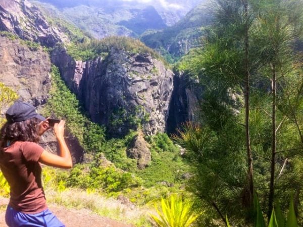
A hiker looking out over a cirque's cliffs from a viewpoint
Trail 06ModeratePlunging views
Cilaos · Mafate viewpoint

Cap Noir Waterfall and Roche Verre Bouteille

Distance

≈ 7 km loop

Elevation gain

≈ 400 m elevation gain

Duration

≈ 3.5 hours

A scenic loop from Îlet à Cordes (Cilaos), a cliffside trail with sweeping views down into Mafate and Roche Verre Bouteille. Less busy than the Maïdo trail, with a wilder feel.

Elevation profile
indicative
1500 m
1100 m
+400 m
Practical info

Access to Îlet à Cordes by road (a bit winding) or 4x4 taxi. The trail is exposed to the sun in places. Worth combining with a night in Cilaos.

Trail markers: Marked National Park trail.
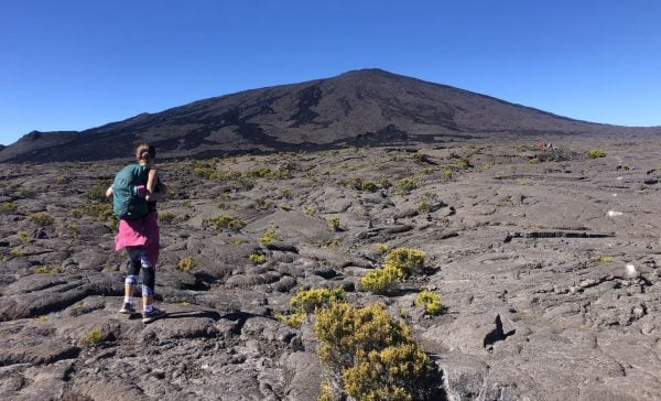
A hiker on the slopes of Piton de la Fournaise with a black lava field and the summit in the distance
Trail 07StrenuousThe Moon on Earth
Volcano · south-east

Piton de la Fournaise via Pas de Bellecombe

Distance

≈ 12 km return

Elevation gain

≈ 600 m elevation gain

Duration

≈ 5-6 hours

France's most active volcano (2,632m). A descent into the Enclos Fouqué, a crossing of a sea of lava, and a final climb to the rim of Dolomieu crater. A spectacular mineral world, with formica léo (small red-orange secondary craters) along the way.

Elevation profile
indicative
2632 m
2200 m
+432 m
Practical info

Check whether the volcano road is open (it closes during eruptions). A very early start from Pas de Bellecombe (2,311m) before the clouds roll in. Sunscreen is essential, as there's no shade. At least 2L of water.

Trail markers: White/red-marked trail through the Enclos Fouqué.

Hikers walking through tall, dry grass at sunset on the high-altitude plateaus
Trail 08StrenuousThe summit of the north
Saint-Denis · 2,277m

Roche Écrite from Le Brûlé

Distance

≈ 16 km return

Elevation gain

≈ 1,100 m elevation gain

Duration

≈ 7-8 hours (a full day)

The classic climb from the north. From Le Brûlé (in the hills above Saint-Denis), a steady climb through tall-grass plateaus, heather and tamarind trees. The 2,277m summit offers views of the Mafate cirque, Piton des Neiges and the ocean as far as Saint-Denis. Doable as a day return for strong walkers, or over 2 days with a night at the Plaine des Chicots gîte.

Elevation profile
indicative
2277 m
1180 m
+1097 m
Practical info

Leave before 7am to finish before the high-altitude clouds roll in. Cool in the morning (≈8-14°C), pack a fleece. Marked as the GR R2. At least 2L of water. A 2-day variant can be booked at the Plaine des Chicots gîte (1,832m).

Trail markers: GR R2 (Le Brûlé to the summit).

A plunging view from a viewpoint over the Mafate cirque, green mountains, a winding river below
Trail 09StrenuousA treasure like no other
Mafate cirque · national nature reserve

Mafate via the Col des Bœufs

Distance

≈ 18-25 km depending on the route

Elevation gain

≈ 1,200 m elevation gain/loss

Duration

2-3 days (gîtes in the hamlets)

Reunion Island's signature experience. Mafate, the only cirque with no road, reachable only on foot. From the Col des Bœufs (2,000m), descend to Marla then continue on to La Nouvelle, Roche-Plate or Aurère. Stay with locals or in a gîte (a simple guesthouse) in one of the îlets (hamlets), with ever-changing scenery at every turn.

Elevation profile
indicative
2000 m
1200 m
+800 m
Practical info

Book gîtes 1-3 months ahead. The dry season is ideal, though Mafate stays walkable almost year-round. Supplies are limited along the way, so pack energy-dense food. The Col des Bœufs is reached by 4x4 taxi from Saint-André (about 1 hr 15 min).

Trail markers: GR R2 and R3 (National Park).

5 Mafate itineraries over 2 days
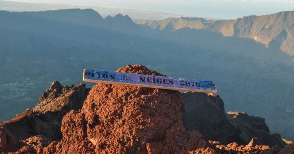
A summit sign for Piton des Neiges at 3,070 metres with a view of the cirque walls at sunrise
Trail 10Very strenuousThe summit
Cilaos cirque · 3,070m

Piton des Neiges from Le Bloc

Distance

≈ 16 km return

Elevation gain

≈ 1,700 m elevation gain

Duration

2 days (a night at the Caverne Dufour gîte)

The roof of the Indian Ocean. The Sentier des Sentinelles from Le Bloc (Cilaos), a night at the Caverne Dufour gîte (2,480m), and a final climb starting at 4am for sunrise at the summit. The reward: a 360° view over every cirque at daybreak, sometimes a sea of clouds covering the whole island.

Elevation profile
indicative
3070 m
1370 m
+1700 m
Practical info

Book the gîte 2-3 months ahead in the dry season. A head torch is essential for the night climb. Pack a fleece and windbreaker (0-5°C at the summit). The dry season is essential (June to October).

Trail markers: GR R2 (Sentier des Sentinelles).

Before you go

Get properly prepared

Check trail status (ONF, Randopitons), the weather forecast (Météo-France Réunion), download offline maps, and pack water and a windbreaker. Start planning a hiking trip to Reunion Island 2-3 months ahead.

Frequently asked questions

Hiking in Reunion Island, in practice

What is the most beautiful hike in Reunion Island?
For the summit: Piton des Neiges over 2 days (3,070m, sunrise, a 360° view over every cirque). For scenery: Trou de Fer (a 300m chasm, a primary-forest atmosphere). For adventure: Mafate, the only cirque with no road. For the volcano: climbing Piton de la Fournaise. The "most beautiful" really depends on your time and fitness level.
Which easy hikes are there in Reunion Island?
The Bébour Botanical Trail (1.5 hours), Formica Léo and Commerson Crater (2.5 hours), Roche Merveilleuse in Cilaos (30 minutes), the Maïdo viewpoint (a lookout with no walking required), Niagara waterfall in Sainte-Suzanne (30m from the car park), Mare à Poule d'Eau (1.5 hours). All are suitable from age 5-6.
How long does it take to hike around Reunion Island?
The GR R2 (crossing the island through the Hauts, the highlands) takes 8-12 days depending on your pace. A tour of the three cirques takes 5-7 days. The Diagonale des Fous (Grand Raid) ultra race is run in 24-67 hours depending on level. For a comfortable walking trip with real exploration, budget 2 weeks.
What's the best season for hiking in Reunion Island?
The dry season (May to November), with the best conditions in September-October. Trails are walkable, skies are clear, mornings are cool. The wet season (December to April) is still possible, but many trails close after heavy rain, and the sea of clouds rolls in fast after 11am.
Do you need a guide to hike in Reunion Island?
Not for the marked National Park trails, which you can walk independently. For a first ascent of Piton des Neiges, a guide or mountain leader is useful for pacing the night climb. Canyoning and via ferratas require supervision by law. A handful of professional guides operate out of Cilaos, Salazie and Plaine des Cafres.
Which app should you use to plan a hike?
Start with Randopitons by GO Sport (the free local reference, 4.5/5, real-time open/closed trail status). Pair it with Visorando (offline IGN maps) and Météo-France Réunion (weather warnings). See my full guide to hiking apps in Reunion Island.
What gear do you need for hiking in Reunion Island?
Ankle-supporting hiking shoes, a light waterproof jacket (the weather changes fast), a fleece for mornings and altitude, at least 1.5L of water, an energy snack, a cap or hat, sunscreen. For multi-day hikes: a light sleeping bag, a head torch, a backup light. See my full Reunion Island hiking gear checklist.
Are the trails open right now?
Check the ONF Réunion website (reunion.onf.fr), which publishes closure orders after cyclones, landslides or works. Randopitons also shows the status of each trail. After a heavy rain event, some ravine or cliffside trails can stay closed for several days.
Go further

Keep reading

Article last updated on 20 October 2026.