Updated September 2026

Mafate hike in 2 days: 5 routes from easy to challenging

Mafate is a cirque (a vast natural amphitheatre ringed by cliffs) you can only explore on foot: go for a weekend and sleep in a gîte or under canvas. Here are 5 routes to suit every level, from Col des Bœufs, open to all, to Col du Taïbit, best left to seasoned hikers.

5routes2 days+ 1 night in a hamletMay - Novemberbest season

If it is your first time on the island, the Mafate cirque is pretty much unmissable. Breathtaking scenery, almost no development, a rare kind of quiet: a 2-day hike into the cirque will almost certainly be one of the highlights of your trip to Reunion Island.

Mafate cannot be reached by car or by bus, only on foot or by helicopter. Over 2 days, you can walk through one or two îlets (the cirque's tiny hamlets), sleep in a gîte (a hikers' guesthouse) or under canvas, and head back the next day by a different route. Below are the 5 routes I keep up to date, with distances, elevation gain, difficulty levels and my recommended places to stay.

At a glance

The 5 routes compared

Choose based on your level and the kind of scenery you want. Click a route to jump to the details.

Good to know

Before hiking into Mafate

The Mafate cirque is remote, with no roads. A few rules to avoid getting caught out once you're there.

Gîte booking
Essential

€40-60 half-board. Book as soon as your dates are set, especially in high season (July-August and French school holidays).

Season
May to November

Dry season, trails in good condition, stable weather. Avoid December-April (cyclones and rain).

Water
2 L per day minimum

Refills are sometimes possible at hamlets but not guaranteed. On the Orangers aqueduct trail, little shade, so bring more.

Gear
30-40 L pack

Worn-in hiking boots, a fleece (cool at night), a head torch, a first-aid kit, full sun protection.

The details

The 5 routes in detail

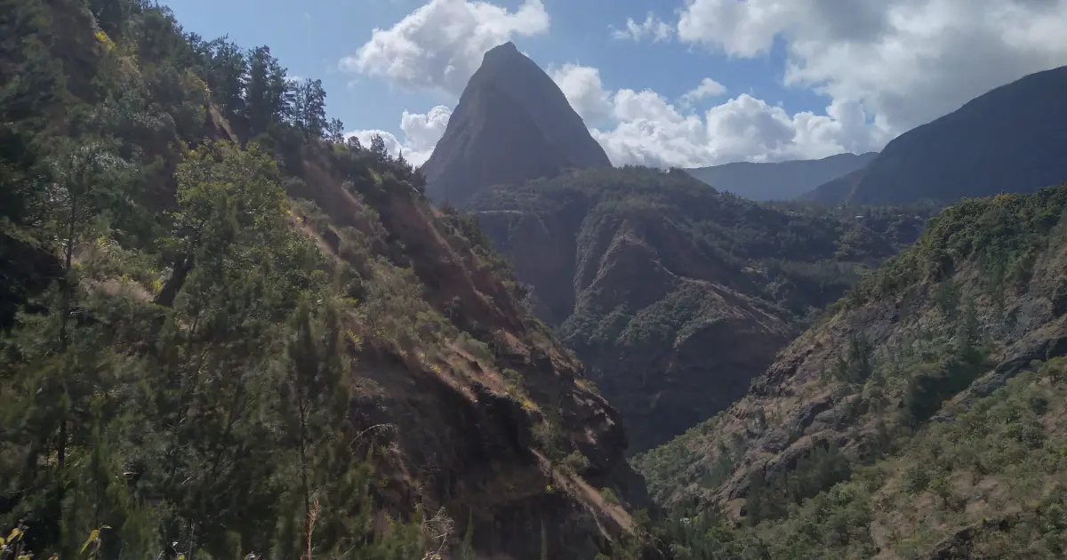
Trail from Col des Bœufs towards La Nouvelle in the Mafate cirque, peaks and tamarind trees
Route 01EasyBest for a first visit

Col des Bœufs to La Nouvelle

Distance
15.1 km
Duration
5 hours
Ascent
820 m
Type
Out and back
Level
Easy

“Easy access, varied scenery, the busiest trail in the cirque. Recommended for a first trip into Mafate.”

What you'll see

Spread over two days, this walk is gentle enough for most people, and it already gives you a fantastic taste of Mafate's landscapes. The trail starts with 20 to 30 easy minutes along a track before properly entering the cirque.

Right at the start, a first viewpoint over the mountains opens the walk. Next comes a popular but perfectly safe descent, with plenty of steps. The trail then flattens out across a plain, where you sometimes pass small cows grazing among the tamarind trees.

At the fork between Marla (left) and La Nouvelle, head down to the hamlet, which gets more and more charming as the first houses come into view. For the return the next day, two options: retrace the same trail, or take the Charrette path, which opens up different views over the cirque.

Detailed route on randopitons.re
Overnight stop

Where to sleep in La Nouvelle

La Nouvelle is one of the most visited hamlets in the cirque, and also one of the most charming. Several gîtes, a few bar-restaurants, and Camping du Cryptoméria right in the middle of the village. In high season or during French school holidays, booking the gîte and dinner in advance is essential (€40-60 per person half-board). Wild camping is tolerated on the grassed areas in the centre of the hamlet, with the landowner's permission.

Before you set off

Where to stay before setting off from Col des Bœufs

Two places I recommend right by the car park: Ti Kaz Lontan, a Creole house perched on the hillside with a warm welcome and convivial meals; Le Guétali, a quiet stay in green surroundings with views over the Mafate peaks, ideal for couples or small groups.
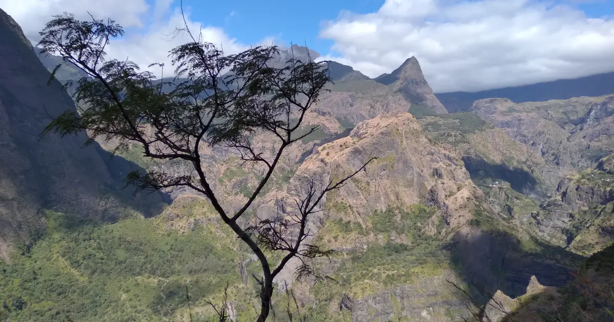
Panoramic view of the Mafate cirque from the Orangers aqueduct trail, with a tree in the foreground
Route 02Moderate

Sans-Souci to Îlet des Orangers

Distance
32 km
Duration
8 hours 30
Ascent
650 m
Type
Out and back
Level
Moderate

“Sweeping views over Mafate along the Orangers aqueduct trail, a hillside path with no equal in the cirque.”

What you'll see

The hike starts with a steep climb over roughly 2 km, either following the track's hairpins or cutting through the woods on steeper shortcuts.

Once at the top, it's 10 km of flat walking along the Orangers aqueduct. You walk along the hillside on a trail with exceptional panoramas over the entrance to Mafate, the mountains ahead, and the Rivière des Galets down to the left. Little shade along the way, so bring sun protection (hat, sunscreen, water).

At the end of the aqueduct, a small, low-flow waterfall and a tunnel mark the start of the climb up to the hamlet. The ascent alternates steps and passages through small gorges, short but tiring after the preceding kilometres. At the "Îlet des Orangers" sign, two paths: left to the main village, right to a smaller hamlet with a sweeping view down over Mafate. The return the next day follows the same trails, this time with the ocean as a backdrop.

Detailed route on randopitons.re
Overnight stop

Where to sleep in Îlet des Orangers

Several options in the village: the gîte run by Mafate's well-known postman, where you can chat about life in the cirque and his job delivering mail; or, in the smaller of the two hamlets, Gîte du Cirque (around €40 half-board) with clean dorms, wood-fired Creole meals, a bar with a pool table, and a small shop run by a welcoming Mafate couple. No campsite or bivouac spot in Îlet des Orangers itself: to camp, head down to nearby Îlet des Lataniers, which has a proper campsite.

Before you set off

Where to spend the night before Sans-Souci

Two places I recommend in Bois de Nèfles, a few minutes from the trailhead: GITE-Hotel La Caz des Orangers, a simple, friendly gîte with home-made Creole dishes and a lovely terrace; La Case Sans-Souci, a small, modern retreat with views over the mountains and the ocean, ideal for a peaceful night before setting off.

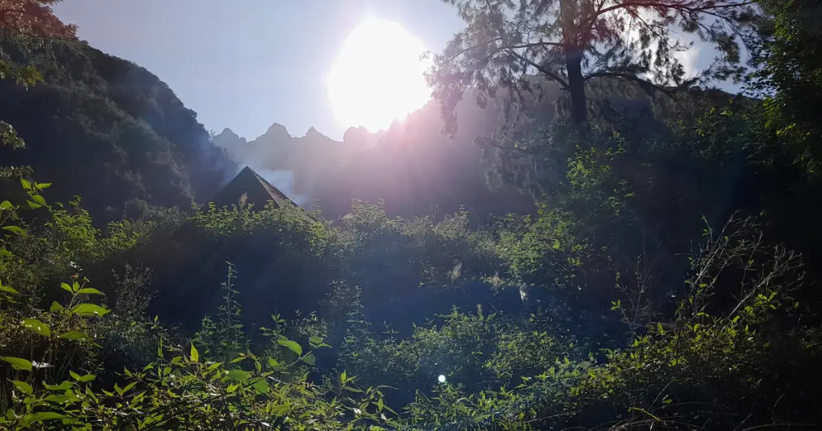
Tent pitched at the forest edge at sunrise on the Col du Taïbit trail between Cilaos and Mafate
Route 03ChallengingMost demanding

Cilaos to Marla via Col du Taïbit

Distance
11 km
Duration
11 hours (over 2 days)
Ascent
1,200 m
Type
Out and back
Level
Challenging

“The classic crossing between two cirques, with 360° views from the top of the pass. You earn every metre.”

What you'll see

Walking from Cilaos to Marla calls for a reasonable level of fitness. The climb up Col du Taïbit is steep and your calves will feel it, but the beauty of the panorama makes it more than worthwhile.

You get straight into it with a zigzagging climb of nearly 300 m of elevation gain up to Îlet des Salazes, where a local association has set up in the middle of nowhere. On site: herbal teas and treats at pay-what-you-like prices, curry available at weekends, and proper bivouac areas if you want to split the walk in two.

Beyond the hamlet, the walk continues towards Col du Taïbit. Just before the summit, a brief respite with a few hundred flat metres before the final 200 m climb. At the pass, spectacular views over both the Mafate and Cilaos cirques at once. A long 430 m descent follows down to Marla, where you settle in for the night before returning the next day along the same trails.

Detailed route on ouest-lareunion.com
Overnight stop

Where to sleep in Marla

There are several options, but the most popular is still Chez Jimmy, the hamlet's snack bar with a lively atmosphere and warm hosts: exactly what you need for a memorable evening. Campers can pitch their tent right next to Chez Jimmy, provided they order their meal there.

Before you set off

Where to stay in Cilaos before Col du Taïbit

Two options in Cilaos: Gîte Ti Case Lontan, a small Creole house right in the village centre, steps from the shops, simple with a stunning view; Hôtel Le Cilaos, more upmarket with a pool, spa, rooms with a view and a fine-dining restaurant, perfect for a little comfort before the effort.

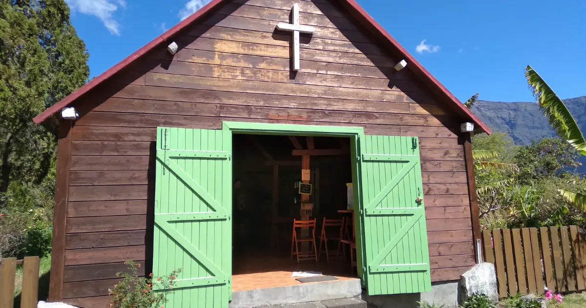
Small wooden Creole church with a green door, typical of Mafate's hamlets (Aurère or Îlet à Malheur)
Route 04Moderate

Deux-Bras - Aurère - Îlet à Bourse - Cayenne

Distance
18 km
Duration
9 hours (over 2 days)
Ascent
1,150 m
Type
Loop
Level
Moderate

“The most hamlets you can fit into two days: 5 villages, riverbed walking, forest, cliffside trail. The fullest way to discover the cirque.”

What you'll see

This hike takes in the most hamlets (5 in total) in the least time. Its variety of scenery is what sets it apart: walking along the riverbed (swimming possible), stretches through forest, and hillside walking with superb panoramas over the cirque.

The first section packs in most of the elevation gain. After a few flat kilometres, the climb towards Aurère begins mid-morning. This very flowery hamlet is ideal for a lunch stop, with a snack bar, a local bakery and grassy areas to rest. You can also sleep there: Tatie Jo's gîte is one of my favourite places to stay in the whole cirque.

For those pushing on to Îlet à Bourse, continue towards Îlet à Malheur (a lovely village with its church at its heart), then La Plaque, and finally Îlet à Bourse for a much gentler end to the day. Allow around 5 hours of walking on day one. The next day, it takes around 3 hours to reach Deux-Bras via Grand Place and Cayenne, with a final choice between the footbridge over the Rivière des Galets or walking along the riverbed if you fancy cooling off. Remember to book the return 4x4.

Detailed route on espritrandonnee.re
Overnight stop

Where to sleep in Îlet à Bourse

A tiny hamlet right at the heart of the cirque. Just a few gîtes, a school, and a small shop (pop in for a drink and to meet Régis, the friendly owner). For a gîte, try Chez Jonny: the welcome is a little reserved but the host is caring and attentive, and the food is among the best in Mafate.

Before you set off

Where to stay before the Rivière des Galets

Two options in La Possession / Rivière des Galets: Au cœur des plantations, a glamping-style stay at the foot of the mountains with comfortable tents, a shared kitchen and a home-made breakfast; Gîte étape Chez Paule et Jo, a simple, clean and warm stay popular with GR R2 hikers, hearty Creole meals and attentive hosts.

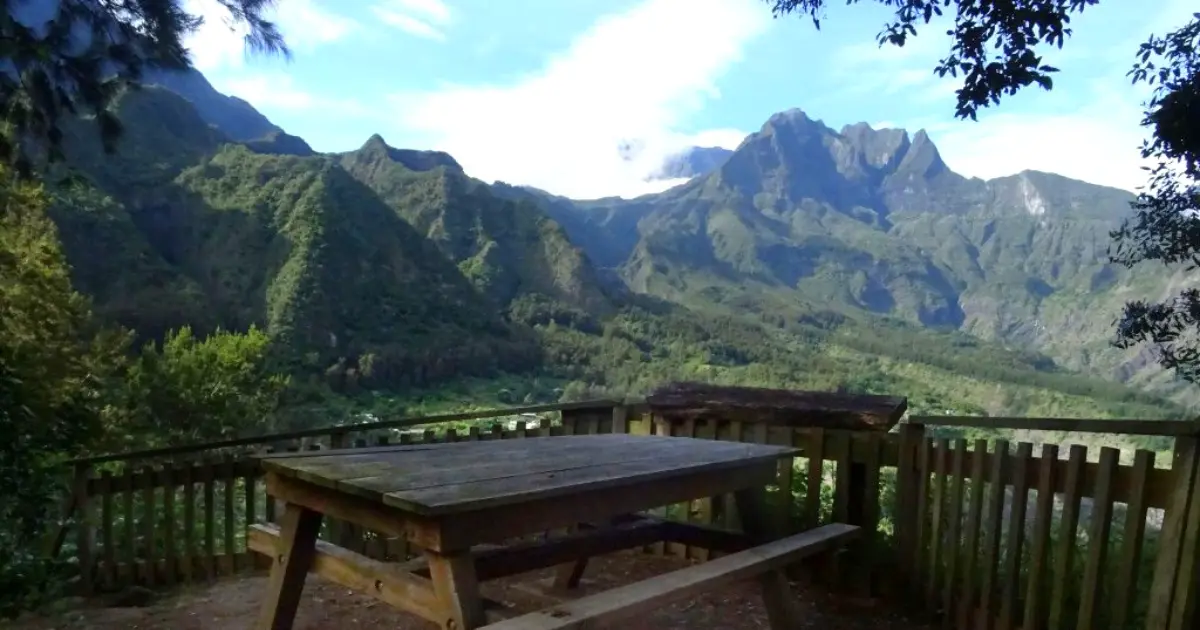
Picnic table on a platform with a panoramic view over the ramparts of the Mafate cirque, near Aurère
Route 05Challenging

Sentier Scout - Aurère - return via Sentier Augustave

Distance
16 km
Duration
7 hours (over 2 days)
Ascent
960 m
Type
Loop
Level
Challenging

“A northern Mafate loop over two of the cirque's finest trails. Waterfalls, ridge walking, aerial views.”

What you'll see

This hike takes in two of the finest trails in northern Mafate. Sentier Scout, almost entirely downhill, opens up a wide range of views over the cirque: forest walking, hairpins, then a ridge with the cirque opening up on both sides. Not particularly hard, but care is needed: plenty of switchbacks, roots and high steps that can catch out less experienced walkers.

At the end of Sentier Scout, La Plaque marks a junction towards different parts of Mafate. Follow signs for Îlet à Malheur then Aurère to end day one (around 3 hours 30 of walking).

The next day, return via Sentier Augustave (recently reopened after several months of works): a mix of cliffside walking (mind the exposure) and a stroll along a ravine floor with a few waterfalls to cool off in. One last short but demanding climb brings you back to the car.

Detailed route on randopitons.re
Overnight stop

Where to sleep in Aurère

Aurère is one of the prettiest villages in the cirque, with flower-filled gardens and wide green spaces. Several places to stay, but the best remains Chez Tatie Jo: a big-hearted host who greets you with a smile and cooks up an exquisite Creole dinner. For camping, several spots to pitch a tent, notably in the heart of the village on a large grassed area with tables and a shelter for cooking.

Before you set off

Where to sleep before Sentier Scout

One option in Grand-Îlet: Ô cœur de l'île, a haven of peace in the highlands of Salazie. Well-kept rooms, an attentive welcome, an optional hot tub and open views over the ramparts. A restful setting, perfect before the big crossing.

Bonus

What about going with a guide?

The 5 routes above can all be hiked independently. For a first visit to the cirque, for safety on exposed sections, or simply to understand the history of these inhabited hamlets, a guided trip is the most relaxed option, and it settles the question of navigation in one go.

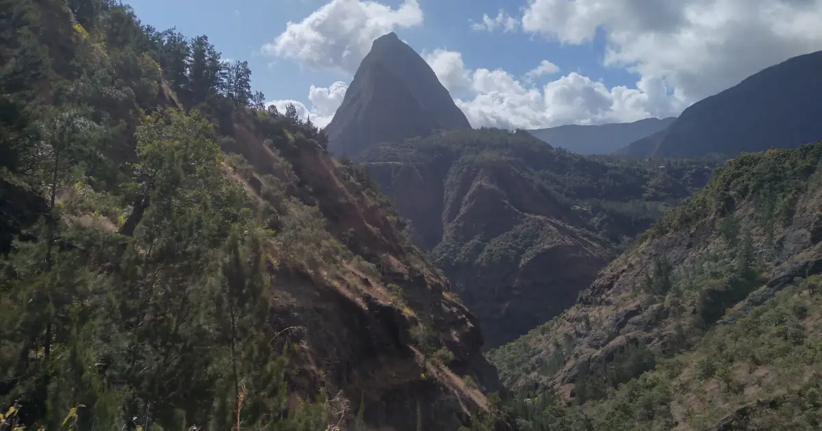
Aerial panorama over the green peaks and river of the Mafate cirque on Reunion IslandBonus

A guided Mafate hike with a local guide

Three options you can book online: the classic half-day to full-day trip (from €55, the most popular), the panoramic format from Le Maïdo without descending to the hamlets (€60, ideal for occasional walkers), and the immersive option meeting local residents (€67). The guide can also put together a 2-day crossing with a night in a hamlet gîte. In every case, a state-certified guide covers the trail, the history of the “petits blancs des Hauts” (the poor white settlers who moved up into the highlands) and the cirque's endemic flora.

From
€55 per person
Verified reviews
4.9/5 · 37 reviews
Guiding
State-certified guide
See the 3 guided options
Not in the mood to hike?

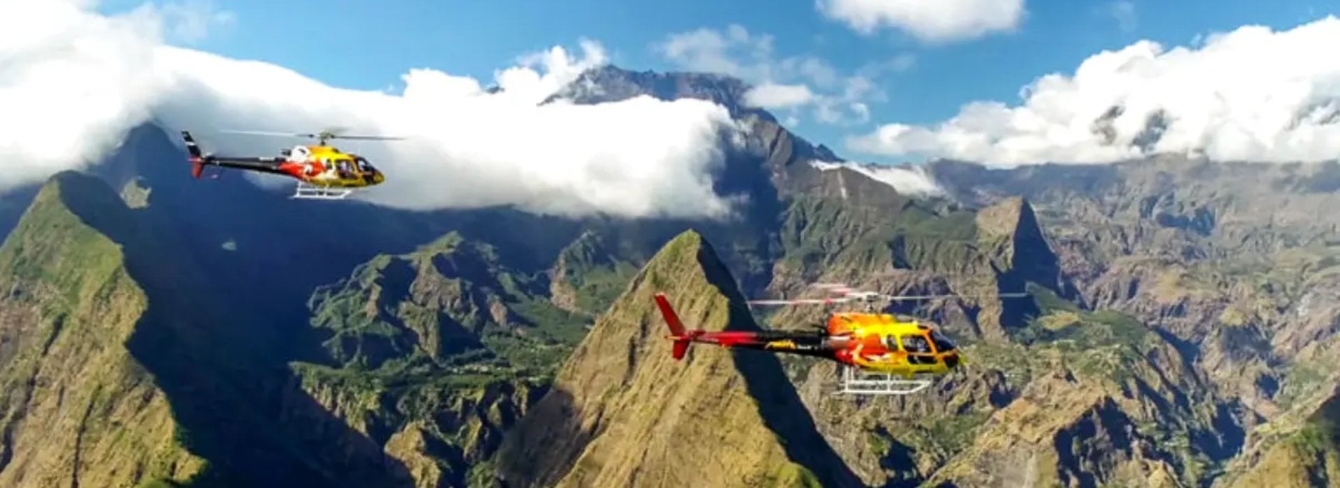
See Mafate from the sky by helicopter

The island's most remote cirque also reveals itself from above. Sheer ramparts, perched hamlets, deep valleys: 25 minutes of flying time from Pierrefonds. An ideal alternative for travellers with reduced mobility, families with young children, or as a complement to a hike (seen from above, you get a much better sense of what you just walked).

See Mafate helicopter rates
Frequently asked questions

Mafate over 2 days, in practice

What is the easiest Mafate 2-day hike?
Without a doubt: Col des Bœufs to La Nouvelle, out and back. 15 km of walking spread over 2 days, 820 m of elevation gain, a wide, well-marked trail, suitable for occasional hikers in good health. It is the busiest trail in the cirque, which is reassuring for a first visit. With children aged 8-10 and up, this is the route to go for.
Can you hike Mafate as a loop in 2 days?
Yes, two loop options are in this selection: Deux-Bras - Aurère - Îlet à Bourse - Cayenne (18 km, 9 hours, 1,150 m of ascent, moderate) and Sentier Scout - Aurère - Sentier Augustave (16 km, 7 hours, 960 m, challenging). Loops avoid retracing your steps and show more scenery, but need a bit more logistics (4x4 shuttle for Deux-Bras, a car parked at the trailhead).
Do you need to book gîtes in Mafate in advance?
Yes, and it is essential in high season (July-August and French school holidays) and at weekends. The hamlets have few beds and plenty of demand. Budget €40-60 per person half-board (bed + Creole dinner + breakfast). For camping, some hamlets (La Nouvelle, Marla, Aurère) tolerate a tent on the grassed areas, sometimes on condition you buy a meal at the village snack bar.
What gear do you need for 2 days in Mafate?
A 30-40 L backpack, worn-in hiking boots, water (2 L minimum per day; refills are sometimes possible at hamlets but not guaranteed), full sun protection (hat, sunscreen, sunglasses: little shade on the Orangers aqueduct trail), a fleece (it gets cool at 1,500 m at night), a head torch, a first-aid kit, and a sleeping bag plus mat if camping. No tent needed if you sleep in a gîte.
Can you hike Mafate with a guide?
Yes, several independent guides and associations offer 2-day guided trips into the cirque. It is reassuring for a first visit, especially to understand the history of the hamlets and the life of their residents. Budget €100-180 per person for a 2-day guided trip (excluding accommodation and meals); half-day to full-day options start at €55. See the bonus section on guided Mafate hikes further down this page.
Is Mafate suitable for families with children?
Yes for Col des Bœufs - La Nouvelle, from around age 8-10 depending on the child's pace. The trail is wide, with no technical sections, and the elevation gain spread over 2 days makes the effort manageable. The other routes in this selection are too long or too technical for children. Choose the low season (May-June, September-October) to avoid the heat and the crowds.
What is the best time of year to hike Mafate?
May to November, the dry season. Stable weather, cool temperatures at altitude, trails in good condition. Avoid December to April, cyclone season, when rain can make some sections slippery or temporarily close trails (check trail status on randopitons.re before setting off).
Can you see Mafate without hiking?
The cirque cannot be reached by car or by bus. Two non-hiking options: the 4x4 shuttle from the Rivière des Galets to Deux-Bras (around €20, though you only reach the edge of the cirque), or a helicopter flight over from Pierrefonds (25 minutes, around €205 per person), which gives the only aerial view over the ramparts and the perched hamlets.
Go further

Keep reading

Article updated 25 September 2026. Sources: routes on randopitons.re and ouest-lareunion.com, based on first-hand accounts from the trails.