Piton de la Fournaise guide: hikes, tours and where to stay (2026)
At 2,632 m, it is one of the most active volcanoes on Earth. Climbing to the Dolomieu crater, a loop around Formica Léo, Plaine des Sables, helicopter flights over eruptions, a lava tunnel, camping at Piton Sec: everything you need to plan your visit, whatever your fitness level.
2,632 m at the summit5 hikes covered in detailPas de Bellecombe 2,311 mMay to November ideal
Quick facts
The volcano at a glance
Summit altitude
2,632 m
Type
Effusive, hotspot
Activity
Very active, ~1 eruption/year
Main access
Pas de Bellecombe
Forest road
RF5 from Bourg-Murat
Distance from Saint-Pierre
1.5 hours by car
Best season
May to November
Dolomieu crater
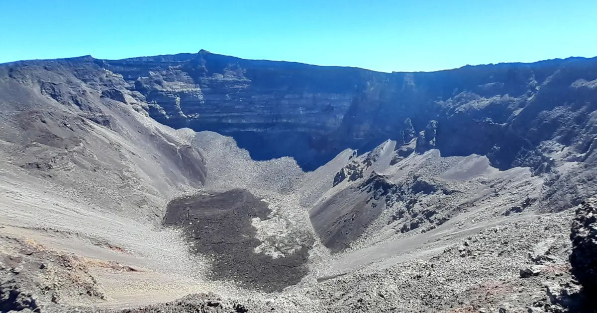
1 km × 350 m deep
Piton de la Fournaise is an effusive volcano, meaning lava flows out slowly with no violent blasts, unlike explosive volcanoes such as Krakatoa or Mount Pelée. This is what makes its eruptions relatively safe to watch: the outer caldera usually stays accessible, and the sight of red flows is one of the safest volcanic spectacles in the world, as long as you respect any prefectural closures.
Understanding the volcano
Geology, history, safety
Before your first hike, a few useful things to know: what to look out for, what to avoid, and what the Piton de la Fournaise Volcanological Observatory (OVPF) has taught us.
An effusive volcano, 530,000 years old
Piton de la Fournaise is a hotspot volcano, like Hawaii. It has built up in successive layers on the south-east flank of the island, around the older Piton des Neiges. The current summit stands at 2,632 m; the Dolomieu crater, which collapsed in 2007, is now 1 km across and 350 m deep.
Eruptions are concentrated within the Enclos Fouqué, a huge U-shaped caldera open to the ocean in the east. Flows sometimes reach the sea, as in 2007 (when the coastal road was cut) or 2002. OVPF monitors seismic activity and ground deformation in real time.
5 volcano hikes
From Formica Léo to Mahavel
Five classic trails, from an easy family walk to a serious challenge. All start from the Pas de Bellecombe or Foc-Foc car parks, reachable by car via the Route Forestière du Volcan (RF5).
1
Dolomieu crater via Bory
Duration
5.5 to 6 hours return
Distance
12 km
Elevation
+520 m
Difficulty
Moderate, unstable terrain
The volcano's signature hike: from Pas de Bellecombe (2,311 m), you drop steeply into the caldera, cross the lava field on its flat floor, climb the summit cone to Bory crater and reach a viewpoint over Dolomieu. You walk along the rim of the crater that collapsed in 2007 (1 km across, 350 m deep).
Tip: Set off before 7am to beat the afternoon cloud. Wear good walking boots and bring 2 L of water and a cap, as the wind is often strong at the summit. Emergency number: 112.
2
Formica Léo and Chapelle de Rosemont
Duration
1.5 hours return
Distance
3 km
Elevation
+80 m
Difficulty
Easy
A short loop from Pas de Bellecombe, descending into the caldera to circle Formica Léo, a small, perfectly shaped red cone. A variant via Chapelle de Rosemont, a legendary basalt boulder, adds 30 minutes.
Tip: Ideal for a first family visit to the volcano. You walk over scoria (loose volcanic cinders), so closed shoes are a must. The rim of the caldera is 100 m from the car park, so you can stop there if you're just passing through.
3
Plaine des Sables, a Martian crossing
Duration
2 to 3 hours
Distance
5 km loop
Elevation
+50 m
Difficulty
Easy
Plaine des Sables is a huge dry collapse caldera, 11 km long and 6 km wide, at 2,100 m altitude. Ochre-red soil, black scoria, a lunar setting that has featured in several films. An easy loop from the Foc-Foc car park, halfway between Bourg-Murat and Pas de Bellecombe.
Tip: A superb spot at sunset. It is very exposed to the wind, so bring gloves and a windproof jacket even in midsummer. Nights are cold: pack a down jacket if camping.
4
Piton de Bert and Piton Sec
Duration
3 hours return
Distance
8 km
Elevation
+220 m
Difficulty
Easy to moderate
South-west of Pas de Bellecombe, Piton de Bert (2,271 m) and Piton Sec offer a quieter alternative: a waymarked trail with sweeping views into the caldera from outside, and the option to return via the Piton Sec camping area.
Tip: The best option if the caldera is closed for an ongoing eruption. The Piton de Bert viewpoint always stays open, with views over recent flows.
5
Pas de Bellecombe to Mahavel
Duration
5 to 6 hours return
Distance
14 km
Elevation
+650 m
Difficulty
Challenging
A serious route that leaves the caldera via the south-east rampart, descends towards the historic 1986 Mahavel flows and gives the most aerial view over the volcano's slopes down to the ocean. The trail is in poor condition in places and makes for a genuine physical challenge.
Tip: Do not attempt it alone without mountain experience; going with a local guide is recommended. It needs good weather, so check the National Park bulletins before setting off.
5 guided activities
Discovering the volcano another way
Don't fancy a 6-hour walk, or want to see the volcano from every angle? Here are five guided options run by local operators, each with its own booking page.
From €12515 to 55 min
Helicopter flight over the volcano
The most striking option during an eruption. Three companies share the market: Hélilagon, Corail Hélicoptères, Mafate Hélicoptères. Take-off from Pierrefonds (Saint-Pierre) or Saint-Gilles. During an eruption, special flights go over the lava flows so you can photograph the active vents as closely as possible.
A qualified mountain guide leads the Bory and Dolomieu ascent, or an off-trail variant for experienced walkers. The guide explains the geology, past eruptions, and adapts the route to the weather and any prefectural closures.
Walk through an old tunnel carved by flowing lava, with a helmet and head torch provided and a caving guide leading the way. The 2004 tunnel on the east flank (access from Sainte-Rose), or a variant on the Plaine des Cafres side. A constant 22°C.
Halfway between a helicopter and a paraglider, a microlight lets you fly over the volcano for less, with an open view. Take-off from Saint-Paul or Saint-Pierre depending on the operator.
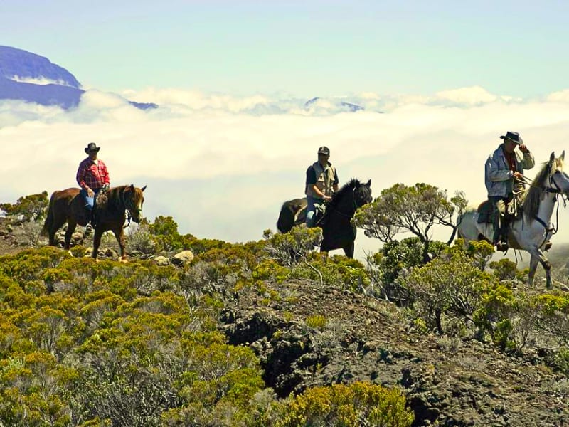
A horse ride along the trails of Plaine des Cafres or right in the volcano area. A relaxed way to enjoy the scenery without the fatigue of walking. Suitable for beginners and families.
When the caldera is closed, a helicopter flight becomes the only way to get close to the lava. Operators adapt their routes to the active vents, headsets are provided and the photos are exceptional. For the best slots, book as soon as an eruption is announced.
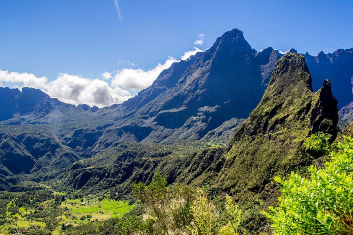
Three logical bases depending on your trip: Plaine des Cafres for an early start to Pas de Bellecombe, Le Tampon to combine the volcano with the south, Cilaos for a weekend pairing the UNESCO cirque with the volcano.
Plaine des Cafres9.6 / 10 (32 reviews)
Le Tranquillou
A gîte (guesthouse) in Plaine des Cafres, a perfect base for an early start to Pas de Bellecombe (45 min by car). Mountain-style decor and a family welcome.
A guesthouse in the Hauts du Tampon (the uplands above Le Tampon), the best value for money in the area. 30 min from Bourg-Murat and 1 hour 15 from Pas de Bellecombe.
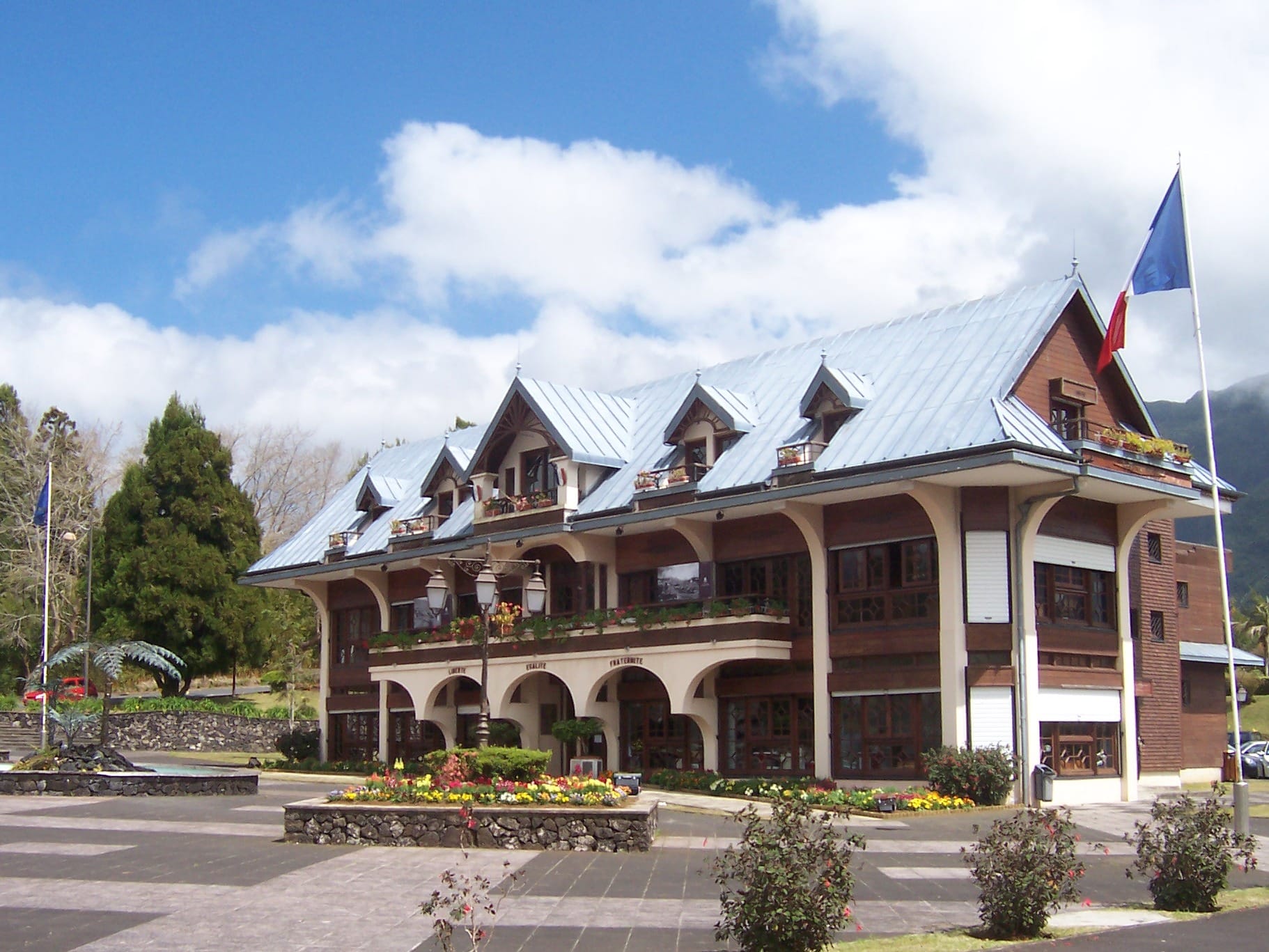
Quiet guest rooms in the Hauts du Tampon, with home-cooked dinners (table d'hôtes) on request. A good option to combine the volcano with the nearby Cilaos cirque.
A premium hotel in the Cilaos cirque with rampart views. For a comfortable stay combining the volcano and Cilaos, it is the top choice in the southern Hauts.
Agoda rates shown as of 25 September 2026 for 2 guests, 1 night. Check availability and the cancellation policy directly on the partner listing.
Camping and self-sufficient travel
A camper van to sleep near the volcano
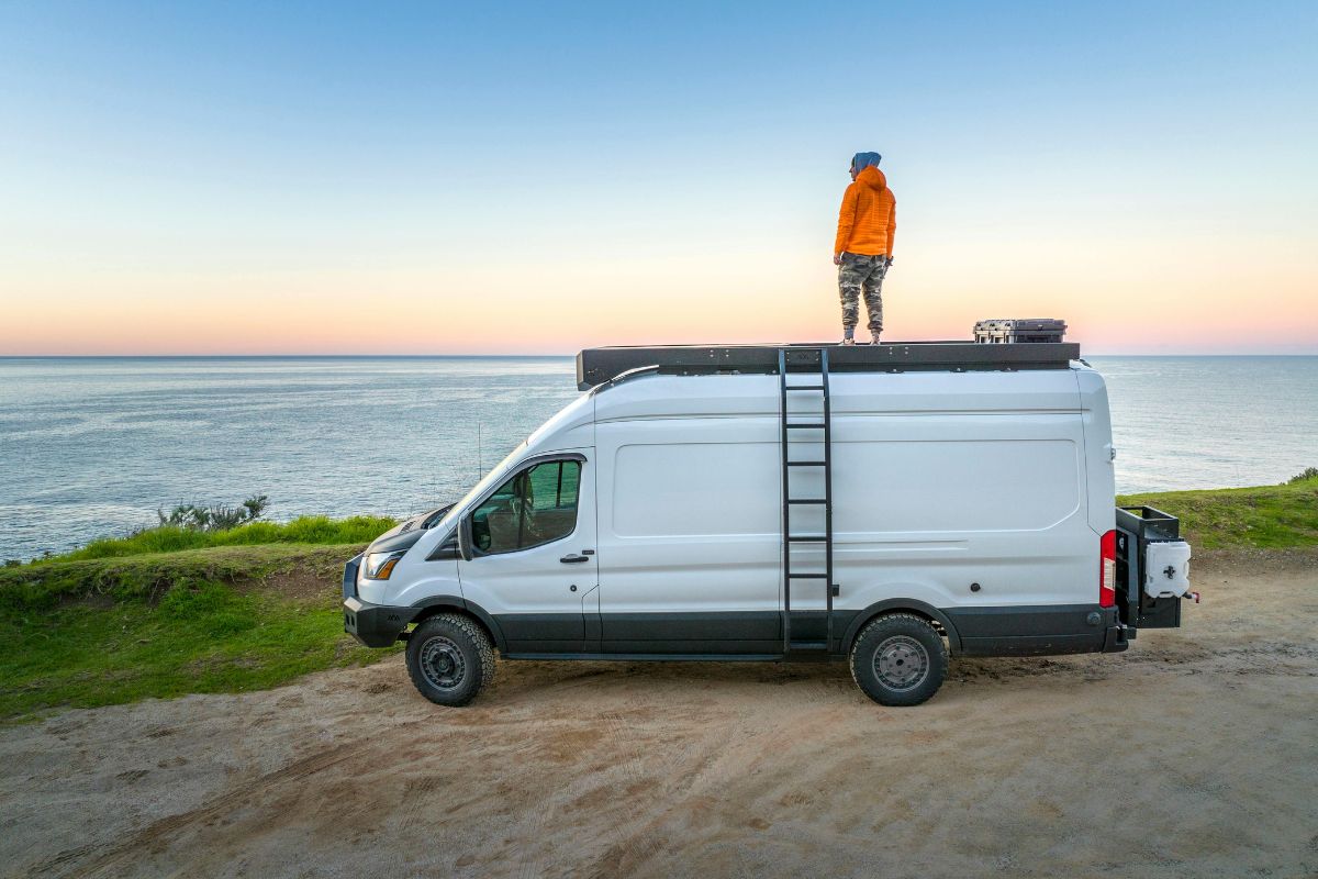
The Route Forestière du Volcan and the Piton Sec area let you sleep close to Pas de Bellecombe and set off before 7am. With a camper van, there's no need to drive up from Plaine des Cafres at dawn. Yescapa connects van owners with travellers. For self-sufficient camping, hard-shell rooftop tents remain a tried-and-tested solution.
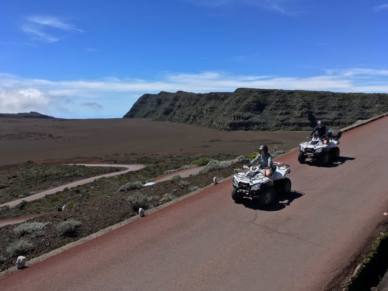
Eight activities in detail: helicopter, guided hike, lava tunnel, microlight, horse riding, quad bike, camper van and the Trou de Fer hike from Bélouve.
Access is from Bourg-Murat (Plaine des Cafres) via the Route Forestière du Volcan (RF5), 30 km of winding uphill road to Pas de Bellecombe at 2,311 m. Allow 1.5 hours from Saint-Pierre and 2 hours from Saint-Denis. You need a car, as there is no regular bus service to the volcano. Route: RN3 to Bourg-Murat, then the RF5 forest road.
Is the volcano dangerous for visitors?
No. Piton de la Fournaise is an effusive volcano, not an explosive one: lava flows out slowly, without violent blasts of rock. During an eruption, the caldera is closed by prefectural order for the duration. Between eruptions, the waymarked trails are open to all and safe, provided you follow the weather advice and stay on the paths.
Can you watch an eruption live?
Yes, when the caldera is open and an eruption is in progress, the flows can often be watched from the Piton de Bert rampart or the outer viewpoints. When it is closed, a helicopter flight remains the only direct way to see the spectacle. Follow OVPF (the Piton de la Fournaise Volcanological Observatory) for real-time status.
Where can you stay near Piton de la Fournaise?
Three options depending on how self-sufficient you want to be. Traditional accommodation in Plaine des Cafres (Bourg-Murat) or Le Tampon, 45 min to 1 hour 15 by road from Pas de Bellecombe. Camping at the Piton Sec area, which is authorised and equipped, a 30-minute walk from the car park. Or a camper van to sleep along the forest road, subject to current local by-laws. Five places to stay are listed above, with Agoda prices.
Can you camp at Piton de la Fournaise?
Yes, at the Piton Sec bivouac area, a designated camping spot at 2,200 m, a 30-minute walk from the Volcano car park. Tent pitches on a prepared platform, basic facilities, non-drinking water. Booking through Le Tampon town hall is recommended in high season. Wild camping outside the designated area is banned in the National Park.
What is the best time to visit Piton de la Fournaise?
Early morning: skies are clear between 6am and 11am, cloud rolls in during the afternoon and often covers the summit from midday. Setting off from Pas de Bellecombe at 7.30am lets you complete a Dolomieu hike before the clouds arrive. During an eruption, the nights are magical, with glowing lava visible to the naked eye from the open viewpoints.
How long does the ascent to the crater take?
For the Pas de Bellecombe - Bory - Dolomieu return trip, allow 5.5 to 6 hours depending on your pace. 12 km in total, +520 m of elevation gain, unstable scoria underfoot. Add an hour for the summit stop and photos. 2 L of water per person, a cap, and a windbreaker are essential. The steep descent back to Bellecombe is as demanding as the climb.
What guided activities are available at the volcano?
Five main options: helicopter flight (€125 for 15 min, up to €345 for 55 min), guided hike (from €55), lava tunnel exploration (from €55), microlight flight (from €99), horse riding (from €50). All can be booked online through Manawa and Funbooker. Several are suitable for families with children aged 7 to 10 and up.
When was the last eruption?
Piton de la Fournaise erupts on average once or twice a year. Eruptions last from a few days to several months. OVPF keeps the official record up to date. See the eruption news page on this site for the latest status and a recent timeline.
What gear should you bring to the volcano?
Closed, worn-in walking boots (scoria shreds thin soles), 2 L of water, a cap, a windbreaker, a warm layer (it can be 5°C at the summit in winter), sunscreen, and a head torch for a very early start. A charged smartphone with the MaRando app for the official National Park GPS track.
Are there restaurants at the volcano?
There is no restaurant at Pas de Bellecombe itself. Bring a picnic, or stop at Gîte du Volcan 3 km from the car park (meals by booking). In Bourg-Murat (Plaine des Cafres, 30 km down the road), several places serve carris (Creole curries) and other local dishes. The Saint-Pierre market runs on Saturdays if you want to stock up before heading up.
How do you combine Piton de la Fournaise with other sights?
Over 5 days, a good combination is 2 days at the volcano (Piton Sec bivouac or a night in Plaine des Cafres), 2 days in Cilaos (a UNESCO-listed cirque 2 hours away) and 1 day on the south coast (Saint-Pierre, the wild south). A camper van lets you do this without doubling back to the coast. See the 7-day camper van road trip guide on this site.