 gite3 km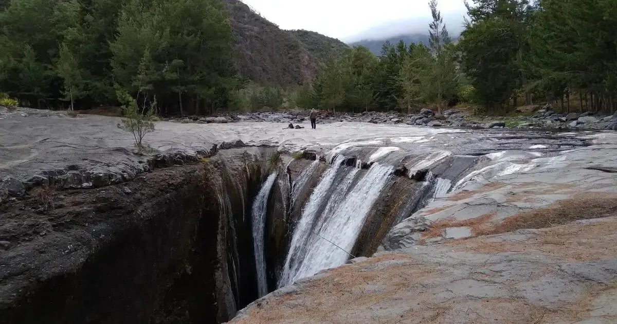
GR R2 · Central Mafate · on-foot access
Trois Roches: waterfall and wild camping at the heart of Mafate
Mafate's most iconic waterfall, over a polished rock bed that ends in a vertiginous canyon. A favourite wild-camping spot for hikers on the GR R2, halfway between Marla and Roche-Plate.
On footGR R2 access2hfrom Marla / La NouvelleWaterfall+ poolsFreeno booking
Trois Roches is unquestionably one of the most iconic sites in the Mafate cirque. Set right at the heart of the cirque on the Rivière des Galets, the waterfall feeds a polished rock bed that ends in a vertiginous canyon. For hikers on the GR R2, it's an unmissable stop, halfway between Marla and Roche-Plate.
Camping at Trois Roches is more basic than at Aurère or Marla: a few spots shaded by casuarina trees, a built fire spot, access to the river. A herbal-tea farm and a honey farm sit a few hundred metres away for light supplies. Since Mafate is inaccessible to vehicles, the option for seeing the site without carrying a pack remains a helicopter flyover.
At a glance
The Trois Roches camping essentials
How to get there
How to reach Trois Roches
From Marla. The trail descends into the Rivière des Galets valley. Allow 2 to 2h30 of walking, with a significant elevation loss on the way back up. The busiest route for those coming via the Col du Taïbit from Cilaos.
From La Nouvelle.The shortest option: 1h30 to 2h of walking, with a moderate elevation loss. Ideal for a half-day camping trip from Mafate's most central îlet (hamlet).
From Roche-Plate. 2h30 of walking, with an up-and-down profile. A classic route for the full crossing of the cirque over 4-7 days.
Backpack
What to bring
- A 35-50L hiking backpack: everything on your back for 2 to 5 hours of walking depending on your entry point
- A 3-season tent plus a 5°C-rated sleeping bag: night-time temperatures at altitude drop below 10°C
- A fleece and a hat: Mafate is dry but the air cools at dusk
- Grippy hiking boots: the GR R2 trail has technical sections in places
- At least 3L of water per person: the Rivière des Galets is close by but should be treated as a precaution
- A gas stove: campfires are banned outside the built fire spots
- Sturdy bin bags: this is a fragile area, and the damage from rubbish left behind is plain to see
Read before the hike
A slippery canyon, a site under strain
A dangerous canyon.The canyon downstream of the waterfall has extremely slippery polished rock, with several serious accidents recorded in recent years. Don't get close to the edge, stay above it on the waymarked area.
A site weakened by heavy use.Trois Roches is visibly deteriorating year after year because of careless visitors (toilet paper left behind, biodegradable waste abandoned). It's essential to stick to the rule of taking all your rubbish with you, hygiene products included. Without that, free access risks being restricted eventually.
Rain and flash floods.During a storm, the river can rise quickly. If rain is falling upstream, don't cross the riverbed and move back from the canyon edge.
Regulations
Wild camping in the National Park: the rules
- 'Tents and hammocks must be pitched before sunset and taken down in the morning'
- 'Do not light campfires': only stoves and the built, designated fire spots are permitted
- 'Take all your rubbish away with you', including toilet paper and biodegradable waste
- 'The use of generators is prohibited'
- 'No harm may be done to wildlife or plant life'
- 'Leave the site as you found it'
Source: Parc national de La Réunion: Wild camping in the Park core. Since Mafate is a sensitive cirque already under pressure from visitor numbers, following the rules is crucial to preserving free access.
Combine it with
Other ways to experience Mafate

Mafate hike from Îlet Cayenne
A guided crossing of the cirque over 1 or more days, with stops at îlets including Trois Roches.
Discover

Wild camping at Piton Maïdo, the other side of Mafate
A western viewpoint over the same cirque, reachable by car.
Discover

Bélouve hike, Trou de Fer waterfall
Primary forest and a vertiginous waterfall on the cliffs between Salazie and Mafate.
Discover
 The other way into Mafate
The aerial option
Mafate without the approach walk
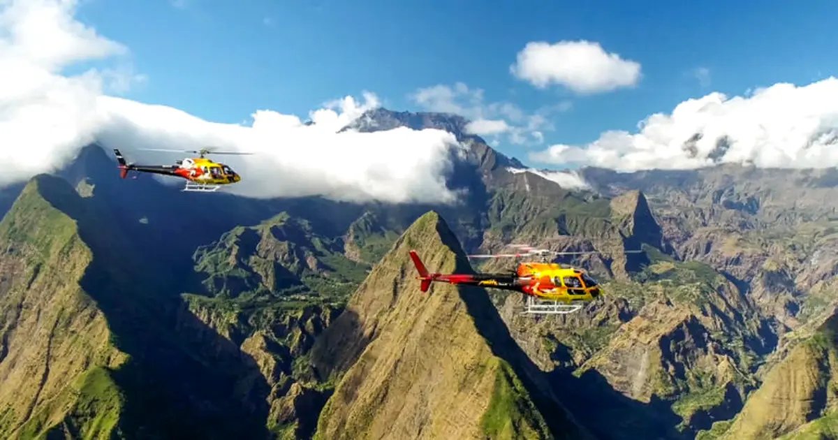
Mafate is the only cirque with no road. To reach Trois Roches: 2 to 5 hours on the trail from Marla, La Nouvelle or Roche-Plate. A helicopter gives you in five minutes of flight what hikers take a full day to discover.
It's also the option for those who want to see Mafate without carrying a backpack. 8 different routes, the short Mafate flight at 15 minutes, the full cirques tour at 60 minutes.
From €125 · 210 Manawa reviews · Saint-Pierre / Saint-Paul
See helicopter rates
Stay nearby
Accommodation at the gateways to Mafate
Since Mafate can't be reached by car, this accommodation sits at the gateways to the cirque (Sans Souci, La Possession).
gite3 km hotel9 km
 hotel15 km
Other spots
Other wild-camping spots in Mafate and nearby
Wild camping at Aurère, Mafate
A neighbouring stop on the GR R2, a more authentic îlet with gîtes and a bakery.
See the spot
Wild camping at Bras Rouge, Cilaos
If you're crossing via the Col du Taïbit from Marla, the natural next stop towards Cilaos.
See the spot
Wild camping at Piton Maïdo
A western viewpoint over Mafate, reachable by car for sunrise.
See the spot
Frequently asked questions
FAQ: camping at Trois Roches
How do you get to Trois Roches?
On foot only, along the GR R2 trail through Mafate. Three main routes: from Marla (2 to 2h30 of walking, the most direct), from La Nouvelle (1h30 to 2h, the shortest), or from Roche-Plate (2 to 2h30). Since Mafate is the only cirque with no road, access is only possible via the trails from Sans Souci, Deux-Bras, Cilaos via the Taïbit, or Salazie via the Col de Fourche.
What facilities are there at Trois Roches?
The site is more basic than the other îlets in Mafate. A few tent spots shaded by casuarina trees, a built fire spot near the rock bed, a water point (the Rivière des Galets right next door, to be treated as a precaution). A herbal-tea farm and a honey farm sit a few hundred metres away for light supplies.
Do you need a permit to camp at Trois Roches?
No, wild camping is unrestricted and free within the core of Reunion Island's National Park. Basic rule: pitch your tent after sunset and take it down in the morning, no fires outside the built spot, and take all your rubbish with you. Since Mafate is a highly sensitive cirque with visible degradation, following the rules is crucial.
Is Trois Roches dangerous?
The canyon downstream of the waterfall carries real risk: extremely slippery polished rock, with several recorded accidents. Don't get close to the canyon edge, especially in the rain or when wet. Stay on the waymarked trail, and view the waterfall from the natural viewpoint downstream. Swimming in the pools above the waterfall is tolerated but risky in the event of a sudden flash flood.
Where does it sit within the cirque?
Trois Roches sits right at the heart of Mafate, on the GR R2, halfway between Marla and Roche-Plate. Allow 2 hours from Marla, 1h30 from La Nouvelle, 2h30 from Roche-Plate. It's a classic stop for anyone doing the full crossing of the cirque over 4-7 days.
Can you see the waterfall without camping?
It's possible as a day round trip from Marla or La Nouvelle if you're in good shape (allow 4 to 5 hours round trip). Otherwise, a scenic flight over Mafate gives you the entire cirque in a few minutes, with the waterfall and canyon visible from the sky without any walking at all.
Page last updated 18 September 2026. GPS coordinates approximated for central Mafate.