Updated 25 September 2026

Piton de la Fournaise eruption 2026: status and history

Your go-to page for following the most active volcano in the Indian Ocean: the 2026 eruption timeline, current status, key facts and every eruption since 1998.

Alert 2-2prefectural level~9 monthsbetween eruptions200+eruptions since 1650
Status on 25 September 2026

Where does the eruption stand today?

The eruption that began on 13 February 2026 stopped on 12 April at 11.10pm, after three successive phases separated by pauses. Since then, OVPF (the volcano observatory) has recorded the volcanic tremor as absent or very weak, but inflation of the summit continues: magma remains under pressure at shallow depth within the edifice. No scenario is ruled out: a resumption on the same site, a resumption on another flank, or an extended pause.

The alert level set by the prefecture is “Alert 2-2”, corresponding to an eruption in progress or paused with activity inside the Enclos Fouqué. To follow day-to-day developments, the best source is OVPF's daily bulletin: free OVPF bulletin. For ground reporting, Imaz Press, La 1ère Réunion and Zinfos974 publish updates within hours.

2026 timeline

The 2026 eruption, month by month

The 2026 episode splits into two distinct eruptions and several stop-start phases. Here is the full, dated sequence.

Four vertical lava fountains jetting from an eruptive fissure at Piton de la Fournaise

Four lava fountains on the main fissure, early 2026.

  1. First eruption after two and a half years of silence

    The volcano wakes up on the north flank, near Piton Jacob. Three eruptive fissures open within hours, the first lava flow since the July-August 2023 eruption. The episode is short: the tremor stops after 33 hours, on the morning of 20 January.

  2. Renewed activity on the south flank, near Piton Morgabine

    OVPF records a new seismic crisis in the early hours. Four fissures open on the south-south-east flank. This eruption will run far longer than the previous one, feeding a lava flow that descends towards the east coast through the Grand Brûlé.

  3. Lava cuts the RN2

    The flow front crosses the RN2 national road between Sainte-Rose and Saint-Philippe, the first time a Piton de la Fournaise flow has crossed the RN2 since 2007. Traffic is suspended, with a diversion through the Hauts (the island's uplands).

  4. Lava reaches the ocean

    Three days later, the flow front reaches the sea below the Grand Brûlé, again for the first time since 2007. On contact with salt water, the lava produces an acid steam cloud that temporarily closes the area to ground observers.

  5. First pause in the eruption

    OVPF records the tremor stopping. Magma remains present at shallow depth beneath the edifice, and the observatory does not rule out a resumption.

  6. Resumption on the same cone

    The tremor returns three days after stopping, and the eruption restarts on the same site. Activity is less sustained, with another pause at 12.10am on 3 April.

  7. Third phase, then a stop at 11.10pm

    A final eruptive phase starts on 8 April, then stops on 12 April at 11.10pm. In total, the February-April episode adds up to around two months of activity spread across three sequences.

  8. Close monitoring, scenario still open

    The tremor disappears on 15 April at 11.20am, briefly reappears on 19 April, then fades again on 21 April. Inflation of the edifice continues: magma remains under pressure at shallow depth. OVPF rules out neither a resumption at the same spot, nor a new site, nor a permanent stop.

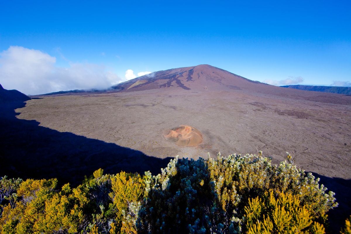
Panoramic view of the Enclos Fouqué with Piton de la Fournaise and the Formica Léo cone below
Fact sheet

Piton de la Fournaise in numbers

The volcano occupies the south-east tip of the island, straddling Sainte-Rose, Saint-Philippe and Le Tampon. A very well-studied geological system, monitored continuously by OVPF since 1979.

  • Altitude
    2,632 m
  • Age
    ~530,000 years
  • Frequency
    1 eruption / 9 months
  • Enclos Fouqué
    ~100 km²
  • Average lava output
    0.32 m³/s
  • Eruptions since 1650
    200+
  • OVPF founded
    1979
  • Before 2026, lava-to-ocean
    April 2007
OVPF monitoring

How do you know an eruption is coming?

Three signals, monitored around the clock, show when the shallow reservoir is building up pressure, which usually means an eruption within a few hours to a few days.

01

Seismicity

As magma rises, it fractures the surrounding rock and triggers volcano-tectonic earthquakes beneath the summit. A typical seismic crisis stacks up several hundred tremors within a few hours. On 18 January 2026, over a hundred tremors preceded the opening of the eruptive fissures.

02

Ground deformation

GNSS stations and tiltmeters measure the swelling of the edifice to the millimetre. Rapid inflation of the summit, a sign that the shallow reservoir is filling, is the most reliable precursor. It is exactly what OVPF continues to measure today.

03

Gas emissions

CO₂ in the soil, SO₂ in the air, helium and radon. When readings climb, fresh magma is arriving near the surface. The observatory samples continuously at several sites across the Enclos.

Dolomieu crater at Piton de la Fournaise wreathed in fumarole steam

The Dolomieu crater under fumarole steam, a sign of the summit's permanent degassing.

See the volcano

The best ways to experience Piton de la Fournaise

Whether the volcano is active or resting, there is always a way to get close to it. Here are the experiences I recommend, all run by local operators.

Eruptive history

Every Piton de la Fournaise eruption since 1998

46 eruptions documented by OVPF between March 1998 and today, listed from most recent to oldest. Notable eruptions (lava reaching the sea, a national road cut, activity outside the enclosure, a fatality) are highlighted in amber.

13 February 2026
60 days, 3 phases
End
12 April 2026
Location
South-south-east flank, near Piton Morgabine

RN2 cut on 13 March, lava reached the ocean on 16 March (first time since 2007), a lava lake formed

18 January 2026
33 hours
End
20 January 2026
Location
North flank, near Piton Jacob

Three eruptive fissures, end of 2.5 years of silence

2 July 2023
39 days
End
10 August 2023
Location
East and south-east flanks

Two fissures on the east flank, one on the south-east flank

19 September 2022
16 days
End
7 October 2022
Location
South-west flank, foot of Piton Kalla Pelé

Formation of Piton Iris

22 December 2021
26 days
End
17 January 2022
Location
South flank

Four eruptive fissures

9 April 2021
46 days
End
24 May 2021
Location
South-east flank

Formation of Piton Guy Valcourt Picard

7 December 2020
1 day
End
8 December 2020
Location
South-west flank, 2,190-2,300 m

Three fissures

2 April 2020
4 days
End
6 April 2020
Location
East flank

Notably intense, paroxysmal episode, formation of Piton Voulvoul

10 February 2020
6 days
End
16 February 2020
Location
East flank

Formation of the Jacques Picard cone

15 September 2018
48 days
End
1 November 2018
Location
South flank, near Piton Jasmin

Five fissures, formation of Piton Daniel Honoré

13 July 2018
18 hours
End
14 July 2018
Location
South-east of the island

Chapelle de Rosemont partly covered by the flow

27 April 2018
35 days
End
1 June 2018
Location
South flank near the central crater

Formation of Piton Jasmin

3 April 2018
1 day
End
4 April 2018
Location
North flank, near Nez-Coupé de Sainte-Rose

Flash eruption

14 July 2017
46 days
End
29 August 2017
Location
Château-Fort sector
31 January 2017
27 days
End
27 February 2017
Location
South-east flank of the terminal cone

Activity mostly in lava tunnels, formation of Piton Timize

11 September 2016
7 days
End
18 September 2016
Location
North of Dolomieu crater

Flows reached the Grandes Pentes on the 17th, formation of Piton Jacob

26 May 2016
29 hours 55 min
End
27 May 2016
Location
Behind the Château-Fort crater

Visible from Piton de Bert

24 August 2015
69 days
End
31 October 2015
Location
Near Rivals crater

Interrupted twice for 3 days, formation of the Kalla and Pélé cones

31 July 2015
3 days
End
2 August 2015
Location
Faujas crater, north-east of Dolomieu
17 May 2015
14 days
End
30 May 2015
Location
Soufrière, migrating towards Château-Fort

Fountains and flows larger than in recent years, formation of Piton Keitti Aki

4 February 2015
12 days
End
16 February 2015
Location
South-west of the enclosure, Dolomieu-Bory-Rivals triangle
21 June 2014
30 hours
End
22 June 2014
Location
South-east flank of Dolomieu crater

End of a 4-year slumber, lava fountains around twenty metres high

9 December 2010
14 hours 45 min
End
10 December 2010
Location
Enclos Fouqué between Dolomieu and Pas de Bellecombe

Three small flows

14 October 2010
17 days
End
31 October 2010
Location
Enclos Fouqué, Château-Fort sector
2 January 2010
11 days
End
12 January 2010
Location
Dolomieu crater

A lava lake formed in the crater floor

14 December 2009
7 hours
End
14 December 2009
Location
South flank of Dolomieu crater

Four fissure systems

5 November 2009
13 hours
End
6 November 2009
Location
Dolomieu crater, south-east and east flanks

Two flows, one of them two kilometres long

15 December 2008
52 days
End
4 February 2009
Location
Dolomieu crater

Flow feeding a lava lake

27 November 2008
2 days
End
28 November 2008
Location
Dolomieu crater

Lava lake

21 September 2008
12 days
End
2 October 2008
Location
Dolomieu crater

Lava lake

2 April 2007
30 days
End
1 May 2007
Location
Dolomieu crater, Grandes Pentes, Grand Brûlé

Major eruption, lava reached the ocean, Dolomieu crater collapsed by 300 m

30 March 2007
10 hours
End
31 March 2007
Location
East-south-east flank, 1,900 m

Flow around 1 km long

18 February 2007
> 10 hours
End
19 February 2007
Location
Dolomieu crater, wall between Dolomieu and Bory
30 August 2006
125 days
End
1 January 2007
Location
Dolomieu crater and east flank

Dolomieu crater entirely filled, snow on the summit 10 October, lava lake

20 July 2006
26 days
End
14 August 2006
Location
South-west flank of Bory, 2,380 m

Formation of Piton La Paix

4 October 2005
106 days
End
18 January 2006
Location
Dolomieu crater, Plaine des Osmondes
17 February 2005
10 days
End
26 February 2005
Location
Plaine des Osmondes, 1,600-450 m

Lava reached the sea, Bois Blanc village

2 May 2004
168 days
End
16 October 2004
Location
South-south-west flank of Bory, Dolomieu, east flank
30 May 2003
226 days
End
10 January 2004
Location
Bory and Dolomieu craters, north and south flanks

Formation of Piton Kaf and Payanke. A young man died after falling into a lava tunnel.

16 November 2002
18 days
End
3 December 2002
Location
East flank of Dolomieu crater, 1,850-1,540 m

Lava reached the sea, formation of Piton Guanyin

5 January 2002
12 days
End
16 January 2002
Location
North-east of the Enclos Fouqué

Lava reached the sea, Bois Blanc village, Vierge au Parasol threatened

11 June 2001
27 days
End
7 July 2001
Location
East-south-east flank, 2,500 m

Formation of Piton Madoré

27 March 2001
9 days
End
4 April 2001
Location
South flank of Dolomieu crater, 2,500 m

Formation of Piton Tourkal

23 June 2000
144 days
End
13 November 2000
Location
South-east flank, 2,100-1,800 m

Lava lake, formation of the Parvedi and Morgabim cones

14 February 2000
19 days
End
4 March 2000
Location
North flank of Dolomieu, 2,490-2,250 m

Formation of the Célimène cone and the Legros crater

9 March 1998
196 days
End
20 September 1998
Location
Plaine des Osmondes, outside the enclosure, north

First eruption outside the enclosure since 1977, formation of Piton Kapor, lava lake

Sources: Observatoire volcanologique du Piton de la Fournaise (OVPF / IPGP), Wikipedia (Eruptive history of Piton de la Fournaise), Imaz Press and La 1ère Réunion. Before 1998, the major reference eruptions are March 1977 (Sainte-Rose overrun), March 1986 (lava reaching the sea at Saint-Philippe) and March 1998 (first eruption outside the enclosure since 1977, formation of Piton Kapor).

Frequently asked questions

Your questions answered

Could a new eruption happen in the coming weeks?
Yes, and it is even likely according to the OVPF bulletin. Summit inflation is measured continuously by GNSS stations, showing that the shallow reservoir remains under pressure. As long as that signal persists, a resumption at the same site or on another flank stays an open scenario. Equally, the volcano could stay quiet for several months before its next episode.
Can you see Piton de la Fournaise erupting in real time?
OVPF's daily bulletin, published on the IPGP website, gives the day's seismicity, deformation and gas readings in detail. When eruptions happen, local press (Imaz Press, La 1ère, Linfo.re, Zinfos974) also covers them in photo and video within hours. To see the volcano in person, the drive up to Pas de Bellecombe via the Route du Volcan is the only public viewpoint open onto the Enclos Fouqué.
Did lava really reach the ocean in 2026?
Yes, on 16 March 2026, nineteen years after the historic 2007 flow. The front descended through the Grand Brûlé to the sea. On contact with salt water, the lava releases a cloud of acid steam (hydrochloric acid) that makes the area toxic for a few hundred metres. Authorities keep visitors at a distance, and the sight is best enjoyed from well back, or from the sky.
Is the volcano dangerous for a tourist visiting Reunion Island?
The Enclos Fouqué is a clearly delimited zone. Every documented eruption since 1998 has stayed within this 100 km² enclosure, well away from inhabited villages. The risk to visitors isn't the lava itself, but carelessness: entering a restricted area, walking on a still-hot flow, or getting close to an acid cloud. The rule is simple: follow the National Park markers and prefectural orders, without exception.
How often does Piton de la Fournaise erupt?
On average, about once every nine months over recent decades. More than two hundred eruptions have been documented since 1650. The 2014-2023 period was particularly active, with 25 eruptions and 9 magmatic intrusions. After a pause of two and a half years, the volcano restarted in early 2026 with two closely spaced eruptions.
What was the longest eruption of the last 25 years?
The 2003-2004 eruption on the Bory and Dolomieu craters lasted 226 days, more than seven months. For sheer spectacle, the April 2007 eruption remains the benchmark: the Dolomieu crater collapsed by 300 m, lava reached the ocean, the RN2 was cut, and the village of Le Tremblet was threatened.
The best option during an eruption

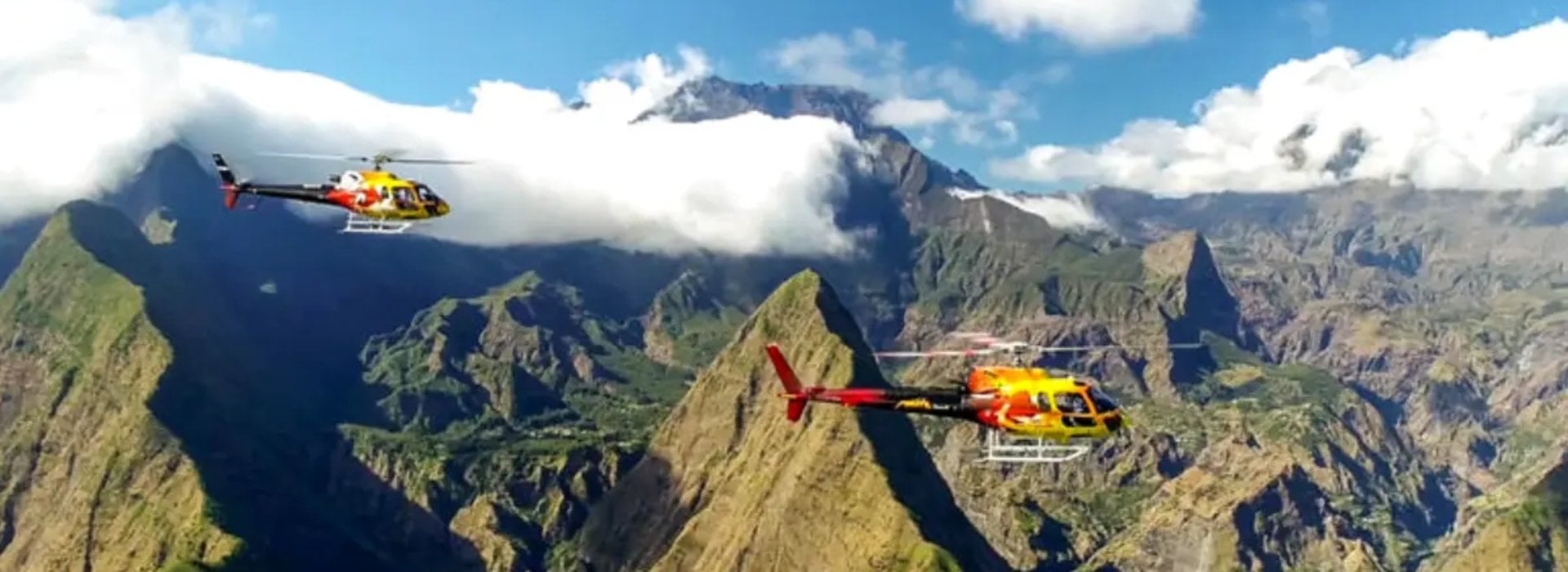
A helicopter flight is still the best angle on the flow

During an eruption, the ground viewing area is pulled back for safety reasons. The flight from Pierrefonds lasts 25 minutes and can be booked as soon as an eruption starts. Slots sell out within hours.

See helicopter rates for September 2026
Go further

Keep reading